Colorado Daily Snow

By Joel Gratz, Founding Meteorologist Posted 9 years ago September 28, 2014
Here comes the storm
Summary:
Rain and snow above 11,000-12,000ft will move across Colorado on Sunday, then another round of showers will hit on Monday. Tuesday will be cloudy with some lingering showers over the northern half of the state, then a cooler storm will bring snow to areas above 8,000-9,000ft on Wednesday afternoon and Wednesday night. Thursday through next weekend will then be dry and sunny.
Details:
On Saturday storms kicked up over the western Colorado mountains starting in the early afternoon and there were some heavier downpours. The heaviest rain was further west over Utah, and this will be what's in store for Colorado on Sunday.
The center of the storm is swirling over Nevada on Sunday morning and it is in no hurry to move anywhere. This is typical of storms that are cut off from the main west-to-east flow of weather.
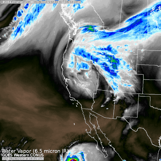
Sunday morning water vapor satellite image. Source: Weathertap.com
As the storm sits over the Great Basin and sloooooowly moves east, two waves of energy will create showers and storms over Colorado.
The first wave of energy moved through Utah on Saturday and Saturday night (I am in Moab, UT, and it rained most of Saturday night, sometimes heavily). This wave is currently over western Colorado on Sunday morning, where a steady rain is falling over the western slope and over the San Juan mountains.
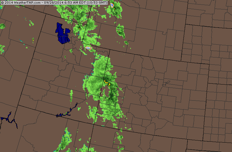
Sunday morning radar image showing heavy rain over western Colorado. Source: Weathertap.com
The rain on Sunday morning is currently west of most of the ski areas, however the San Juan mountains (Silverton, Telluride, Durango, Wolf Creek) are seeing snow over about 11,500ft to 12,000ft.
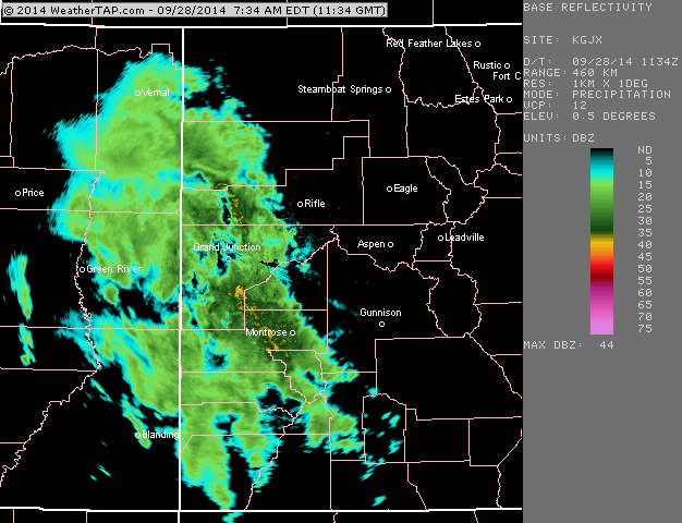
Western Colorado radar as of Sunday morning. The precipitation is falling as snow above about 12,000ft. Source: Weathertap.com
Here's how the rest of the storm will play out:
- On Sunday, the rain over western Colorado will move east across the state through the day. Most mountains will see rain and snow above 12,000ft by the afternoon.
- On Monday, another wave of rain and snow will move across the state. Snow levels will likely drop down to 10,000 ft, and there could be severe storms over the eastern plains. The atmosphere will be agitated and will let us know!
- From Monday night through Tuesday night, a moist flow from the west will keep clouds pressed against the central and northern mountains with continuing rain showers and snow over about 9,500ft. If this were winter, Tuesday would be a potential powder day for Steamboat, the higher elevations of Summit County, and perhaps Aspen as well.
- From Wednesday midday through Thursday morning, a colder storm will swing through Colorado from the northwest with another round of rain and snow. It should be cold enough for accumulating snow down to perhaps 9,000ft, with flakes potentially falling down to 8,000ft from Aspen north to I-70 and Steamboat. Still a little uncertain on how cold the air will be, but the take away is that by Thursday most mountains will have a fresh coat of a few inches of snow.
Following the storm, Thursday will be dry and sunnier with snow melting on the mid slopes. Friday, Saturday, and Sunday will be lovely fall days with snow on the peaks, still some golden Aspen leaves left along mid slope, and average temperatures for fall. A glorious weekend:-)
The next chance of a storm will be sometime mid to late the following week, between Wednesday October 8th and Sunday October 12th.
JOEL GRATZ
About Our Forecaster
Joel Gratz
Founding Meteorologist
Joel Gratz is the Founding Meteorologist of OpenSnow and has lived in Boulder, Colorado since 2003. Before moving to Colorado, he spent his childhood as a (not very fast) ski racer in eastern Pennsylvania.
Free OpenSnow App


