Colorado Daily Snow

By Joel Gratz, Founding Meteorologist Posted 9 years ago September 29, 2014
The mountains are turning white
Summary:
A few inches of snow will fall for most mountains Monday afternoon and Monday night above about 10,000ft. Tuesday will be cloudy with high-elevation snow showers for the northern half of Colorado, then another storm will bring 2-4 inches of snow to many mountains on Wednesday afternoon and Wednesday evening. Thursday through the weekend will be dry and sunny.
Details:
Rain and snow (above 12,000ft) moved across Colorado on Sunday with the heaviest rain (0.50-1.00 inches) falling on the western slope.
On Sunday night, another batch of showers moved across the state and with the temperatures being cooler by a few degrees, snow fell down to about 11,000ft. Here is the view to the east from the top of Copper Mountain on Monday morning. Nice to see some white on the peaks of the 10 Mile range!
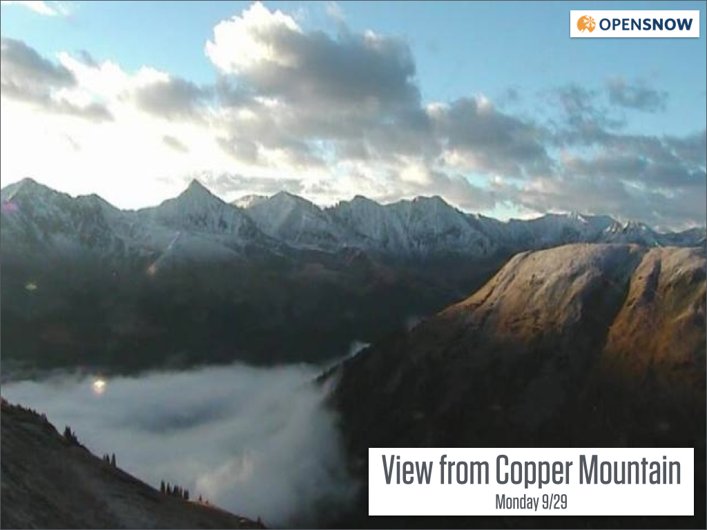
Source: Webcam on OpenSnow.com via Copper Mountain
After a dry morning on Monday, another round of showers will move through Colorado on Monday afternoon and Monday night. This batch of showers is currently over southern Utah.
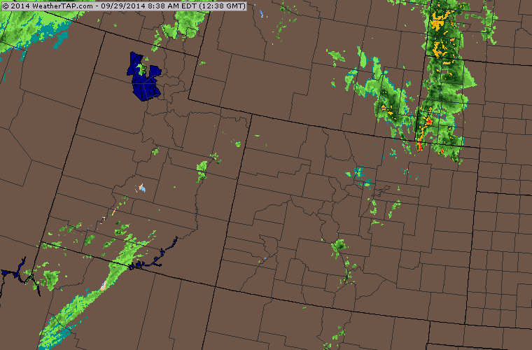
Radar at 8am Monday. Source: Weathertap.com
Similar to Sunday, look for snow levels around 12,000ft during the day, then they will fall to about 10,000ft on Monday night into Tuesday morning. Most mountains will pick up a few inches of snow at the higher elevations, and the passes above 10,000ft could be snowy by Tuesday morning.
Tuesday will continue the trend for clouds and showers for the mountains from Crested Butte north to I-70 and Steamboat. While there could be showers at any time during the day, it appears that a stronger wave will move through on Tuesday evening bringing another inch or two of snow.
Wednesday morning might dawn dry, then one last wave of energy will move through Colorado on Wednesday afternoon and Wednesday night. This will be the coldest wave and should drop snow levels to 8,000-9,000 for central and northern Colorado. From mid-mountain to the summit of many ski areas across central and northern Colorado there will likely be 2-4 inches of snow during this time as total precipitation should be about 0.2-0.4 inches (convert at about a 10-to-1 liquid-to-snow ratio).
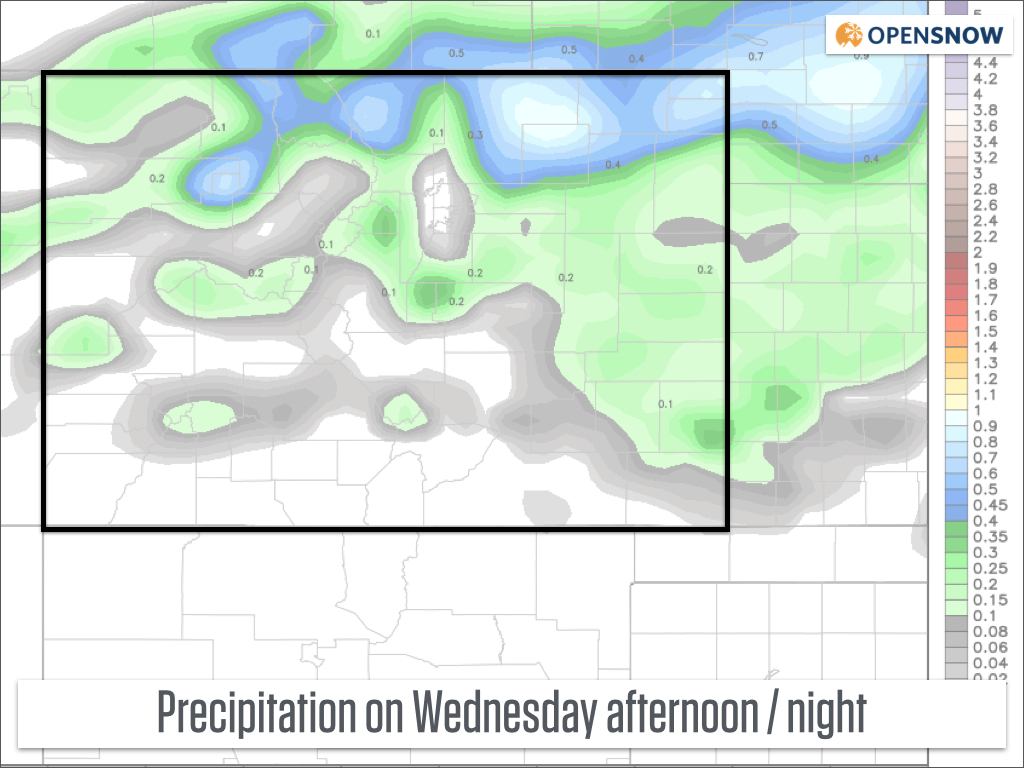
Forecast from the American GFS model for Wednesday night. Source: Weatherbell.com
If this week occured during the winter, I'd say Tuesday morning and Wednesday last run / Thursday first run would be great times to ski. However, this week it's Thursday morning that will be a great time to take photos as the mountains turn white with some Aspen leaves remaining at mid slope and clear skies overhead.
Starting on Thursday and continuing through the weekend we'll see dry and sunny skies with comfortable temperatures in the 60s for many mountain areas during the day. It'll be another glorious weekend to enjoy Colorado's fantastic scenery while doing nearly any sport you can think of (except for skiing, of course:-).
The next shot at cooler air and precipitation will likely come sometime between Thursday October 9th and Sunday October 12th.
JOEL GRATZ
About Our Forecaster
Joel Gratz
Founding Meteorologist
Joel Gratz is the Founding Meteorologist of OpenSnow and has lived in Boulder, Colorado since 2003. Before moving to Colorado, he spent his childhood as a (not very fast) ski racer in eastern Pennsylvania.
Free OpenSnow App


