Colorado Daily Snow

By Joel Gratz, Founding Meteorologist Posted 9 years ago October 29, 2014
Splitting storm for Sunday and Monday
Summary:
- Dry and sunny Wed, Thu, Fri
- Few showers on Sat, mostly in San Juans
- Cooler with snow Sun & Mon, accumulations likely under 6 inches
Details:
October's temperatures have been about 2-3 degrees above average for Summit County (I looked at this area because it's central and where many of the early-to-open ski areas are located). Two to three degrees may not sound like a lot, but it is significant over the time span of one month. Looking back at the past 100 years, only 20% of Octobers have been warmer than this one. So, temperatures during October 2014 have not been unprecedented, but they have been on the high end of the scale. Unfortunately this has forced Keystone and Copper to delay their openings.
Temperatures will continue to run average to above average through Friday with plenty of sun and just a few high cirrus clouds.
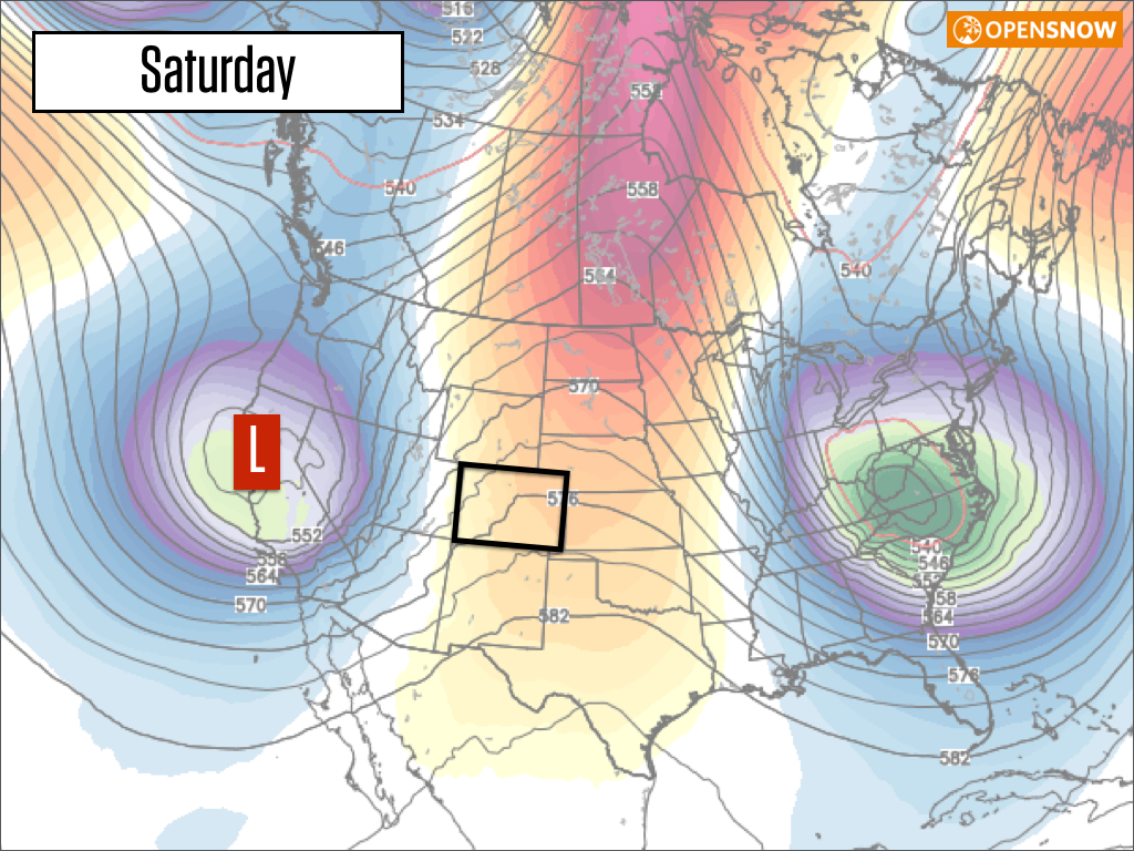
On Saturday, moisture will push into the state from the southwest. This could produce a few afternoon showers, but most areas will be dry. The exception is over southwestern Colorado in the San Juan mountains where the midday and afternoon showers could be more significant and might produce a few inches of snow.
Also, on Saturday, our next storm will push into California giving them much needed snow and rain.
However, by Sunday into Monday, this storm will split into two pieces, which means that Colorado will NOT experience a direct hit.
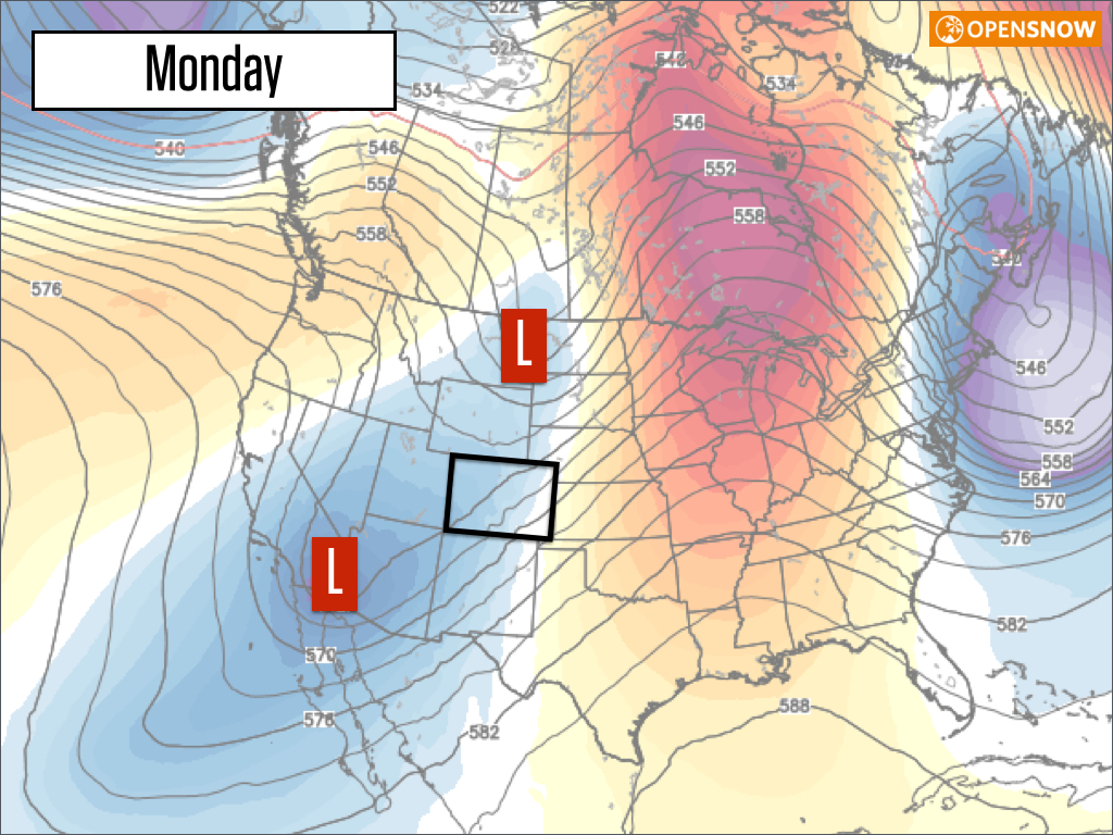
In terms of temperatures and snowfall, look for cool and cloudy conditions on Sunday with snow showers, especially during the afternoon. The snow showers will continue Sunday night and likely last through Monday. Since the storm is splitting, it's likely that the snow showers will come through in weaker waves rather than in one strong push, so it's hard to time the heavier snow and pin down the location of the best accumulations. Overall I see this storm as delivering perhaps an average of 2-4 inches to most areas with a bit more in spots.
Snowmaking conditions will improve from Sunday night through next Tuesday with the cooler air, which is good news even when natural snow accumulations look to be on the low side.
The rest of next week should be dry with maybe a few showers from the southern part of the splitting storm that might sit around for a few days. In the long range, the next chance for a storm will likely be around November 10th, plus or minus a few days.
JOEL GRATZ
Event Announcements:
- My friend Joel Bettner climbed and skied Denali (a 20,322ft mountain in Alaska) this past summer. He'll be talking about the experience at REI Denver tonight 10/29 and at REI Boulder next Wednesday 11/5. Both events are free. Here's a highlight film he made about the experience.
- CAIC's Benefit Bash (party!) is next Saturday, 11/8, in Breckenridge. Tickets are $40, are good for beer, food, a raffle, and entertainment, and the money supports CAIC. More info here.
About Our Forecaster
Joel Gratz
Founding Meteorologist
Joel Gratz is the Founding Meteorologist of OpenSnow and has lived in Boulder, Colorado since 2003. Before moving to Colorado, he spent his childhood as a (not very fast) ski racer in eastern Pennsylvania.
Free OpenSnow App


